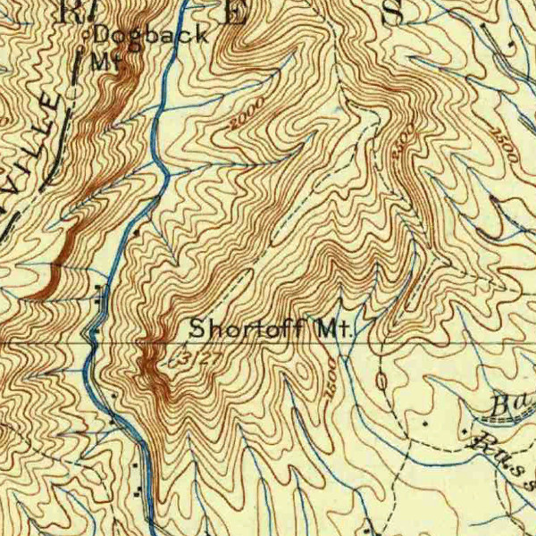
USGS has a great new online tool for finding and downloading their old topo maps. Gathered under the umbrella of Historical Topographic Map Collection, you’ll find dozens of relevant topos in several scales and file formats.
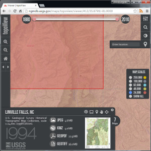
“Historical” apparently doesn’t include the 21st century, so the now outmoded 2011 maps are not included (see the USGS Store). Also, the collection is extensive but not complete, so your research may need to include other sources, such as the UNC North Carolina Maps Collection or the University of Texas North Carolina Historical Topographic Maps.